In the Šariš region in the 9th - 12th centuries, hermit monks - eremites, who chose safe locations in remote places for their activities, were active. One such centre was near Mirkovce on the peak of Malá Zobrana.
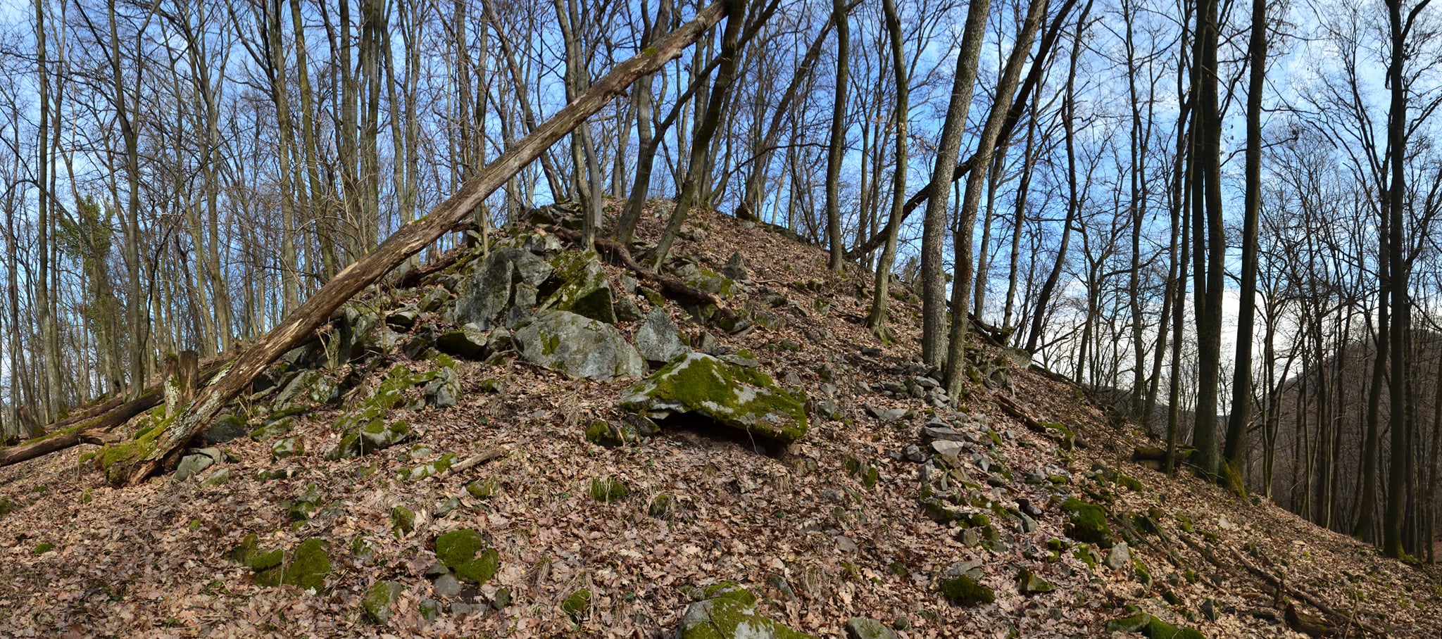
The peak of Zobran is situated on the western side of the mountain between the villages of Mirkovce and Brestov. Big Zobrana has an altitude of 610 metres. Little Zobrana It is slightly lower, with its summit at an altitude of 460 metres above sea level. An interesting fact is that the whole of Šariš was surveyed from this spot. Until recently, an old stone trigonometric pillar served as a reminder of this. At the summit of Malá Zobrana lies a rarity that one does not come across very often.
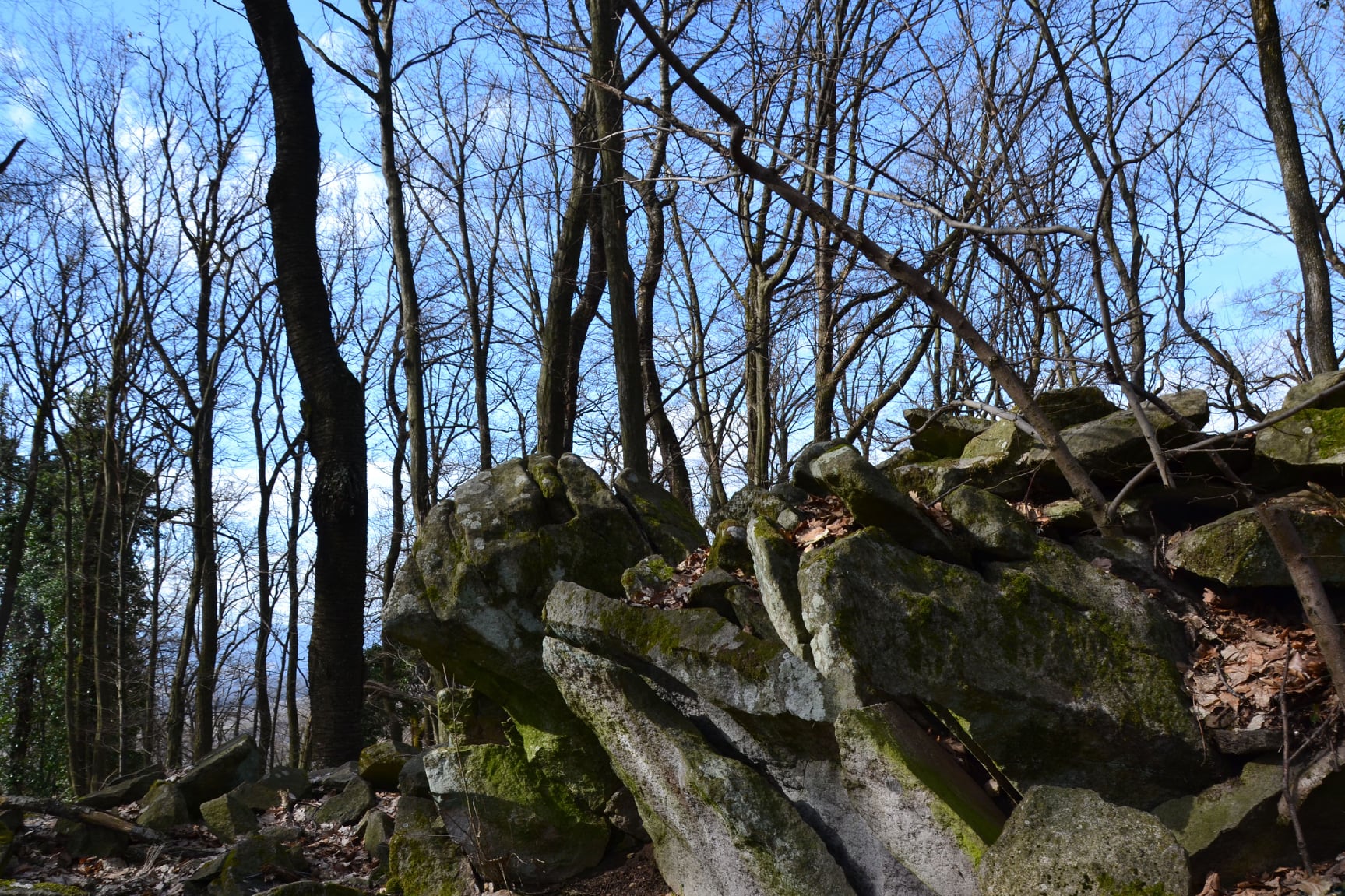
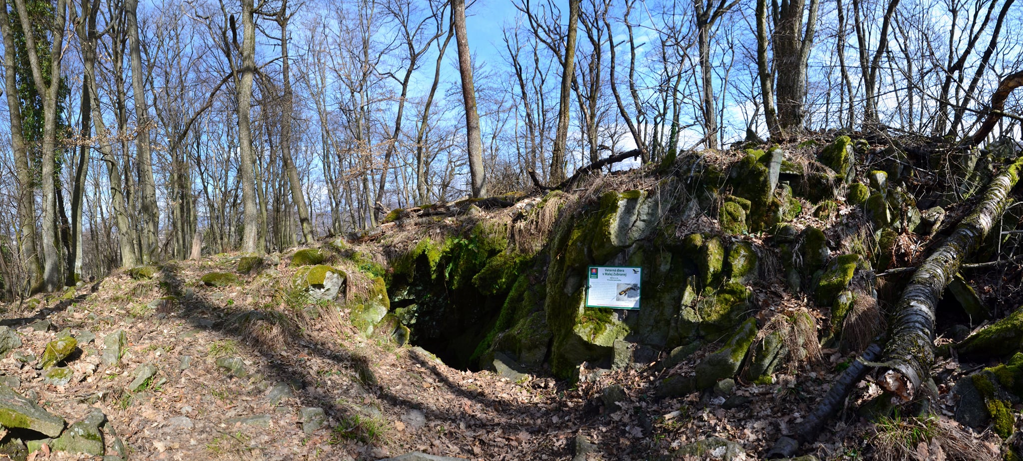
Roughly in the middle of the summit, amongst the rocks, there is an opening leading into the depths of Malá Zoborana. It winds its way down between the rocks towards the stream and emerges from another rock by the stream, which people have named "Zimná skala". The opening between the rocks of the massif was used by hermits when they were in danger. Through this rocky opening, they could reach the village by the Balka stream. This made it easier for them to evade bandits or even members of Arpád’s retinue, who would sometimes penetrate this territory. On the summit plateau, there are visible terraces, probably the remains of an ancient settlement.
The Wind Hole has been known to locals since time immemorial for the extremely strong draughts that blew outwards in the winter months. It is so strong that it blows out the leaves that we put into the hole. Even in hot summer, cold air, or draught, penetrates through the aforementioned hole between the rocks. In winter, green plants can be seen around it and all over the summit plateau. The wintering spotted salamanders, which seek out this place with its moist and warm air, are an exception.
Source : KST Prešov
Source of photographs: fb-Presov
Map
Gallery
Information
The first, and shortest, route is from the north, past the former hunting lodge in Mirkovce. On this route, you’ll need to cross a stream, an orchard and some thickets on your way to the summit.
The second option is from the village of Žehňa, although this route is longer.
The third, most pleasant route leads across the ford on the Balka stream, then through meadows to the edge of the forest, and from there along a forest track to the pass between Malá and Veľká Zobrana. The turn-off to the ford is halfway along the road from Mirkovce to the hamlet of Potôčky.